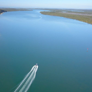
Year in Review – 2018 – Shaping our waterways
2018 has been a busy year – read all about what we’ve done to continue to improve access to and management of our waterways here

2018 has been a busy year – read all about what we’ve done to continue to improve access to and management of our waterways here
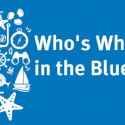
At the Gold Coast Waterways Authority, we’re determined to not get tied up with red tape or give members of the public the run around on waterways management questions. We know that governance of Gold Coast waterways can often be complex and confusing and that it is very important to get to the right person to handle each query quickly.
That’s why we’ve developed “Who’s Who in the Blue”.
It’s a handy tool to help identify;
We hope “Who’s Who in the Blue” is valuable to you!
2017 was an exciting one as we worked hard to secure the future of the Gold Coast’s waterways. Read our Year in Review here: Gold Coast Waterways Authority – Delivering on our waterways 2017
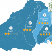
 Figure 1: Southern Catchments 2016/17 Report Card. Source: Healthy Land and Waters 2016/17 report card hlw.org.au/reportcard
The 2016/17 Healthy Land and Waterways Report card has been released, with waterways in the Southern catchments ranging from fair to good. The grades presented an overall decrease in waterways health in the southern region, in most part due to an increase in sediment loads.
The effects of ex-Tropical Cyclone Debbie were highlighted through increase sediment and pollutant loads coming from the upper catchments, stressing the importance of good streambank vegetation to reduce erosion and the amount of sediments entering our waterways. The report has also highlighted that in urban areas, the use of effective stormwater management will further increase the resilience of the region to extreme weather events.
Acknowledging the findings of the report card, the Gold Coast Waterways Authority are proactively exploring ways to maintain and enhance the condition of the Gold Coast waterways, including:
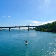
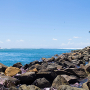
Our Gold Coast waterways are a mainstay of the Gold Coast’s lifestyle, underpin the Coast’s identity, and provide opportunities for locals and visitors to undertake recreational activities on and beside the waterways. In April 2017, we conducted and reported on the economic and social values of our waterways.
We engaged NCEconomics, an independent consulting firm, to conduct the analysis and to report on the economic and social values of the Gold Coast’s waterways to the community and businesses. We invited the community to contribute to the management of our waterways through an online survey.
The survey covered some basic information about the participant’s households or businesses and their views about our waterways. The marina and waterway-based tourism industries were of particular interest due to the significant reliance of waterways to underpin businesses, and due to the fact that quality waterways stimulate the purchase and use of vessels of all shapes types and sizes.
Outputs from our study will include developing an economic profile of the marina and waterway-based tourism industries (size, contribution to Gross Regional Product, direct and indirect employment etc.) and insight to better understand the importance of waterways to your industry. Our report will also be publicly available as a resource to industry.
 Gold Coast Waterways Authority (GCWA) recognises that the existing values the community places on Gold Coast waterways will be challenged in the future through population growth, a changing climate and other pressures. This acknowledgement led to the development of GCWA’s draft Resilience Plan.
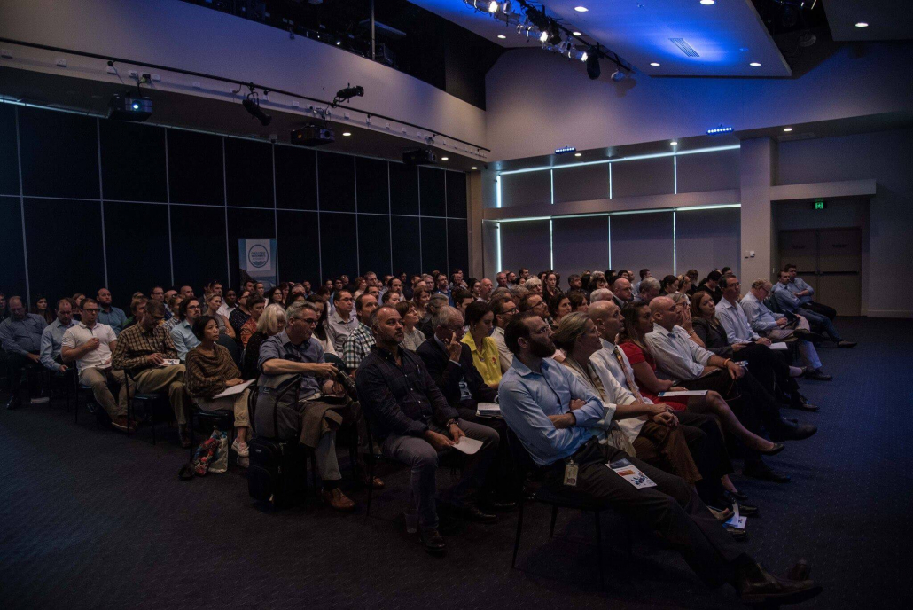
The GCWA was proud to lead the first-ever conversation with the people of the Gold Coast on the long-term future of our waterways ‘Gold Coast Waterways 2017 and Beyond’ was held on the 22nd May 2017 and hosted close to 200 participants from industry, academia, community and business.
We were delighted to welcome a number of key agency speakers including keynote speaker Susanne M. Torriente, Chief Resilience Officer from the City of Miami Beach:
How would the Gold Coast bounce back from a major weather event such as extreme flooding or a hurricane? What about an event twice the size of ex-tropical Cyclone Debbie? As a water city, we’d all be impacted. Susy addressed lessons from Miami, in particular how Florida coastal cities are building resilience. In the lead up to our resilience symposium, Susy chatted with ABC Gold Coast about what the Gold Coast can learn from the Miami experience.
The full program, which includes detailed information about our speakers, can be accessed here: Program: Gold Coast Waterways 2017 & Beyond
Outcomes from the day will assist in sculpting the Resilience Plan which is expected to go out for public consultation later in 2017.
Photo credit: Elise Strålberg, Griffith University and Nicole Munro, GCWA

Predominant southeasterly winds, the significant northern drift of sand and wave climate combined to move an estimated 500,000 cubic metres of sand along the south-east Queensland coast each year.
Over time the Nerang River mouth moved northward by up to 60 metres each year, causing land erosion and changing sandbanks at the bar and adjoining Broadwater.
In the early 1800s the Nerang River entered the Pacific Ocean where the Gold Coast Convention Centre is located. In 1930 the entrance was where Seaworld is today.
It was estimated that by 2050, the entrance would be opposite Runaway Bay if no action was taken, and the township of Currigee on South Stradbroke Island would be in danger.
Sadly, it was too late for Moondarewa. Moondarewa was a coastal town established on Stradbroke Island. In 1984 it sat in the centre of the Southport Bar and was lost forever to the volatile Nerang River entrance. This is a clear indication of the obstacle that the untrained Bar presented to development of the Broadwater and adjacent land.
In the late 1970s, the Queensland Government conducted intensive research into the possible solutions and in 1983, the Queensland Government took action to stabilise the river mouth.
Research revealed that with the magnitude of the northward drift of sand along the coastline, any scheme to stabilise the entrance would require a commitment to artificially bypass sand across the river mouth in perpetuity. The Delft Hydraulics Laboratory of Holland, which had previously researched and reported on the beach erosion problems on the Gold Coast, again in 1976 presented a report to the Queensland Government which established a number of parameters which would be used in the final design of the scheme.
It was clear that the most economical approach would be to construct two breakwaters to form a new entrance through the Spit, just south of the existing entrance. Model studies at this time aided the design of these walls to ensure they would be capable of withstanding the cyclonic conditions that may be encountered.
It was also shown that orientation of the breakwaters to 15 degrees north of east and increasing the length of the southern wall would reduce the entry of ocean swells. Other model studies investigated the effects of wave penetration into the Broadwater. From this evolved the need to construct an island. Wave Break Island, to capture storm waves and protect the western foreshore of the Broadwater.
The number of methods were then evaluated to bypass sand across the entrance. As no comparable system existed elsewhere in the world, this task was not an easy one.
The system finally selected involved pumping sand trapped by the southern wall through a pipeline under the seaway to discharge onto the ocean beach of South Stradbroke Island.
Finally an exhaustive environmental study of the entire scheme was undertaken. With satisfactory answers to all questions, the Queensland Government, in 1983, decided that the Nerang River Entrance Stabilisation Scheme should proceed. The epic project cost $50 million and used one million tonnes of imported rock, two layers of 20 and 25 tonne concrete cubes (4,500 cubes in total) and dredged 4.5 million cubic metres of sand.The large-capacity fixed-sand bypassing system is an integral part of the design of the seaway and currently pumps 500,000 cubic metres of sand across the Seaway each year.
Today, the Gold Coast Seaway facilitates transit between the Broadwater and the ocean for recreational and commercial vessels. The sand bypassing system, ongoing dredging and construction of Wave Break Island have ensured that the entrance to the Broadwater was stabilised without detriment to surrounding beaches. The Gold Coast Seaway is an unqualified success proving that although nature can’t be tamed, she can be guided.


Who’s Who in the Blue explains who is responsible for managing, protecting and
regulating Queensland’s waterways, particularly on the Gold Coast.
It clarifies agency roles across safety, environmental protection, pollution response,
compliance and infrastructure, helping avoid confusion and duplication.
Overall, it’s a quick reference guide that supports coordination, accountability and
effective waterway stewardship.
The Gold Coast Waterways Authority acknowledges and pays respect to the traditional custodians, the Yugambeh peoples of South East Queensland, including the Kombumerri, Mununjali, Wangerriburra, Bullongin and other clans, and their Elders past, present and emerging. We recognise their unique and ongoing spiritual and cultural connection with the land and waters of the Gold Coast area.
Any damaged or missing aids to navigation such as beacons, buoys, markers or signs, should be reported as soon as possible on 07 5539 7350.
For community engagement, communications or media enquiries please contact mail@gcwa.qld.gov.au