Unlocking the Potential: The Top of The Spit’s Precinct Plan
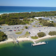
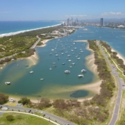
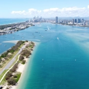
The full potential of one of Queensland’s most stunning coastal parklands is set to be unlocked with the reveal of a detailed precinct plan for The Top of The Spit, Main Beach.
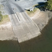
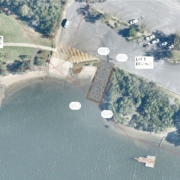
The Gold Coast Waterways Authority is upgrading the boating facility at Oxenford. This project involves installing a new pontoon to the west of the existing boat ramp and expanding the existing boat ramp’s footprint by four metres to accommodate an extra lane.
Major improvement works have commenced this week at a popular boat ramp at The Spit, with local based company Ertech (Queensland) Pty Ltd awarded the contract for construction.
The works are expected to take 11 months to complete and will improve the operational use of the site by reducing congestion during peak periods and enhancing access and safety for launching and retrieving vessels. Once finished, the park will offer a total of six boat ramp lanes, an upgraded pontoon, a new floating walkway on the northern boat ramp, 160 trailer parks, 144 car parks, 6 car parks for people with disabilities, line marking, pathways, landscaping, public toilets and shade.
This $19M project is funded by the City of Gold Coast, Queensland Government as part of the implementation of The Spit Master Plan and Gold Coast Waterways Authority, and will enhance access to the Broadwater and the Seaway for recreational and commercial vessels as well as community organisations.
To enable works to be completed safely and as quickly as possible, the Muriel Henchman Park boat ramp and main carpark will experience temporary disruptions from August 2023 to mid-2024. Delays may be experienced as well as reduced number of boat lanes and car parking available.
Alternative launch points include Proud Park, Broadwater Parklands, Harley Park and Loders Creek. For updates and more information on the Muriel Henchman Park Improvements visit HERE.
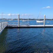
The repairs of the Southport Broadwater Parklands pontoon have been completed, and the facility is now open again for use.
Upgraded materials have been used to improve the performance and life of the structure, with the repairs costing $470,000.
Thanks to the community for their cooperation during the closure of the pontoon over the last two months.
The pontoon is a popular structure that supports recreational activities such as sporting events, fishing and waterway access. It’s also used by vessel owners that use the adjacent boat ramp to access the waterways.
To find out more about this project, please view our project fact sheet.
A popular Paradise Point boat ramp near the Broadwater is undergoing major upgrades.
The $950,000 project commences in mid-June 2023 and will see recreational boat ramp lanes at Jabiru Island expanded and upgraded to the latest specifications.
The Jabiru Island boat ramp is an important access point for recreational boaties. It is located on the southern side of Jabiru Island, near the junction of the southern arm of the Coomera River, Coombabah Creek, and Saltwater Creek.
Gold Coast Waterways Authority (GCWA) Chief Executive Chris Derksema said maintaining boat ramp facilities was an important part of ensuring safe navigable access for waterway users.
“Especially as demand for these facilities continues to climb on the Gold Coast,” Chris Derksema said.
“These upgrades are part of the $50.4 million investment in construction and upgrade projects to improve access to the Gold Coast waterways recommended in the Gold Coast Waterways Management Program 2022‐26.
Boaties and other recreational users will be able to access three other mixed‐use lanes on weekends while the work is carried out.
The Jabiru Island boat ramp upgrades project is expected to be completed in July 2023. More details are available in the project factsheet.
The Gold Coast Waterways Authority (GCWA) is acting on climate change and investing in projects that support a sustainable future for the Gold Coast’s iconic waterways.
GCWA Chief Executive Officer Chris Derksema said work was already well underway in response to the severity of climate change and its potential impacts to our waterways and community.
“We acknowledge that climate change is the most significant environmental challenge that humans have faced, and we recognise the impacts of increasing global temperatures on climate patterns, extreme weather events, and ecosystems around the world,” Chris Derksema said.
“In response, we are actively mitigating our own climate change impacts and preparing for the future, allowing us to maximise sustainable and resilient waterways services and infrastructure at the same time.
“While we are making a concerted effort to build sustainability into our own operations, we’re also working closely with our suppliers and stakeholders to make improvements where possible.”
Chris Derksema added that the foundations for action had been set by a robust Climate Change Policy which sets clear and achievable targets for GCWA, including the reduction of its greenhouse gas emissions.
“We recently adopted a Climate Change Policy that supports GCWA in better managing the effects of climate change and provides a framework for improved climate-related oversight and governance,” Mr Derksema said.
“The Policy confidently outlines our commitments, including the adoption of carbon emissions reductions targets, and how we’ll integrate climate change into our business operations.”
Key targets and collaborative actions under the GCWA Climate Change Policy include:
A popular bay at the Top of The Spit in Main Beach has been opened to a broader range of recreational uses under a new 12-month trial that separates powered watercraft from passive recreation activity.
The Gold Coast Waterways Authority’s Recreation Uses Trial in Marine Stadium will support the transition from a predominantly long-term anchoring site to an area that supports a range of recreation activities.
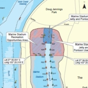
At the centre of the trial activated on Friday 31 March is a Recreation Opportunities Area in the northern 300 metres of Marine Stadium which will be reserved for non-powered watercraft, freeing up the space for passive leisure opportunities such as fishing, sailing, stand-up paddle boarding and kayaking.
Powered watercraft can access the new jetty and pontoon through a 45-metre-wide channel and dedicated use area for dropping off passengers and vessel manoeuvring.
GCWA Chief Executive Chris Derksema said the Recreation Uses Trial was a significant step towards realising the full potential of Marine Stadium as a waterways destination that everyone can enjoy.
“This trial is a significant step towards fulfilling the vision of Marine Stadium outlined in line with The Spit Master Plan’s (2019),” Mr Derksema said.
“The community feedback we’ve received for Marine Stadium has been overwhelmingly in support of a shift to improved access to the water by limiting the number of vessels anchored in this area.
“We have also listened to concerns about the impacts of long-term anchoring on water quality which have been verified by the Marine Stadium Tidal Exchange Study.”
The study recommended GCWA adopt a management option that separates vessels from other recreational uses is the most effective way of supporting a range of recreational activities within Marine Stadium. The establishment of a recreational opportunities area responds directly to this recommendation.
Mr Derksema said the trial was underpinned by a Waterways Notice which outlines the regulations for vessels using each of the areas established in the Recreation Opportunities Area.
“We think this management option strikes the right balance between continuing to allow access by boat users, but also opens up the area to others,” he said.
“The Waterways Notice clearly sets out the perimeters of the new recreation opportunities area, the jetty and pontoon use area, and the approach channel into Marine Stadium.
“We will monitor and evaluate how the trial is performing throughout the year.”
The Recreation Uses Trial zone includes:
A study into the flow of water between Marin Stadium and The Broadwater has been completed as part of the implementation of The Spit Master Plan.
During consultation on the master plan the community expressed the desire for water conditions to be assisted to better support recreational activities.
The six-month study included field testing, options analysis and computer modelling that confirmed the water in the northern end of Marine Stadium has limited tidal exchange with The Broadwater.
It was demonstrated by computer modelling that the connection of Marine Stadium to The Broadwater via a channel, pipe or culvert would not adequately improve the flow of water.
A management option that reduces the opportunity for illegal discharges and distances vessels from recreational users is recommended. This option is shown to be the most effective way of supporting a range of recreational activities.
The recommendation for a management option will be used to inform GCWA’s planning for the future of Marine Stadium that is currently underway.
To learn more about the findings of the Marine Stadium Tidal Exchange Investigation visit: https://gcwa.qld.gov.au/spit-master-plan/ .
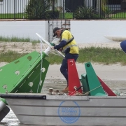
Following the recent severe weather event, the GCWA team is busy out on the Gold Coast waterways recovering lost buoys, repairing damaged beacons and other navigation aids, and monitoring sunken vessels for pollution at multiple locations.
While the focus remains on the Nerang and Coomera Rivers, GCWA keeps assessing and responding to damage across the primary channel network.
Despite the heavy rain easing and sunny skies returning, boaties and all waterways users are encouraged to stay away from the waterways because of the risk presented by floating debris, submerged hazards and strong current flows for many days following the torrential rains.
Please stay safe and keep up-to-date with advice from Bureau of Meteorology, the City of Gold Coast and Maritime Safety Queensland. Follow us on Facebook for more information from GCWA.
A $300,000 project to improve waterways access from the Alberton boat ramp on the Logan River has been completed, just in time for the school holidays.
We’ve aid the Gold Coast Waterways Authority (GCWA) has widened the Alberton boat ramp on the Logan River from one to two lanes.
‘The northern Gold Coast is one of the fastest growing areas of the city, so we need to keep pace with demand for access to the waterways network in that area.
‘Widening the boat ramp will improve traffic movements particularly in busy periods.
‘The angle of the boat ramp has also been realigned to improve the launching and retrieving of boats.
‘Now that the upgrade is open, more people will be able to use the Alberton boat ramp as a launching point for exploring the Logan River and the waterways beyond it,’ Minister Bailey said.
The Alberton boat ramp upgrade is one of several projects being undertaken by GCWA as part of its $34.7 million Gold Coast Waterways Management Program.
CEO, Hal Morris, said feedback received from a recent community survey conducted by GCWA had identified a need for alternatives launching spots to busier boat ramps such as Jacobs Well.
‘The upgrade at Alberton increases the access options for boaties who might want to avoid some of the busier spots, especially on weekend.
‘We’ll continue to work with the community, particularly in the northern Gold Coast area, to identify ways of improving access to our beautiful waterways destinations.

40-44 Seaworld Drive
Main Beach Qld 4217
PO Box 107
Southport Qld 4215
Who’s Who in the Blue explains who is responsible for managing, protecting and
regulating Queensland’s waterways, particularly on the Gold Coast.
It clarifies agency roles across safety, environmental protection, pollution response,
compliance and infrastructure, helping avoid confusion and duplication.
Overall, it’s a quick reference guide that supports coordination, accountability and
effective waterway stewardship.
The Gold Coast Waterways Authority acknowledges and pays respect to the traditional custodians, the Yugambeh peoples of South East Queensland, including the Kombumerri, Mununjali, Wangerriburra, Bullongin and other clans, and their Elders past, present and emerging. We recognise their unique and ongoing spiritual and cultural connection with the land and waters of the Gold Coast area.
Any damaged or missing aids to navigation such as beacons, buoys, markers or signs, should be reported as soon as possible on 07 5539 7350.
For community engagement, communications or media enquiries please contact mail@gcwa.qld.gov.au
GCWA managed multi-use destinations, building infrastructure for commercial and recreation use of Gold Coast waterways.
Status: Closed
The Sand Bypass System (SBS) jetty is a working platform and is closed to the public whenever construction activity, sand pumping operations or maintenance works are underway, or during severe weather events.
For safety reasons, the jetty will remain closed until the end of 2026 while essential maintenance and ongoing sand pumping operations continue. We appreciate your understanding.
To find alternative jetty facilities, please visit the GCWA Destinations Map.
GCWA’s tidal works mapping is a public resource for general information purposes only.
The tidal works mapping is not a cadastral survey or hydrographic survey product. It should not be relied upon as the basis for making any decision, whether a business, conveyance, development, property boundary, property description, property title, property transaction, or any other decision.
GCWA makes no warranty, representation, or guarantee, express or implied, as to the accuracy, completeness, content, reliability, suitability, or timeliness, with respect to the information or related graphics.
GCWA has taken care in preparing the mapping information, but accuracy is not guaranteed, and the information contained in the tidal works mapping must not be construed or used as a legal description of any property. Under no circumstances will GCWA be liable for any damages whatsoever, including business interruption, loss of business information, loss of data, loss of profits, property valuation, or any other damage, arising from use or misuse of this tidal works mapping.
Any errors or omissions should be reported to GCWA in writing by email to mail@gcwa.qld.gov.au.
Status: Closed
The SBS jetty is a working platform and for safety reasons is not open to the public during construction projects, when operating, undergoing maintenance or during severe weather events.
Until the end of 2025 while maintenance works, and sand pumping operations take place, the jetty will be closed.
Your understanding is appreciated, to find alternative jetty facilities please visit the GCWA destinations map.
Tidal works mapping information
GCWA’s tidal works mapping information is a public resource for general information purposes only. It is not a cadastral survey or hydrographic survey product. It should not be relied upon as the basis for making any decision, whether a business, conveyance, development, property boundary, property description, property title, property transaction, or any other decision. GCWA makes no warranty, representation, or guarantee, express or implied, as to the accuracy, completeness, content, reliability, suitability, or timeliness with respect to the information or related graphics. GCWA has taken care in preparing the mapping information, but accuracy is not guaranteed, and the information contained in the GCWA Open Data Portal must not be construed or used as a legal description of any property. Any errors or omissions should be reported to GCWA in writing by email to mail@gcwa.qld.gov.au. Under no circumstances will GCWA be liable for any damages whatsoever, including business interruption, loss of business information, loss of data, loss of profits, property valuation or any other or damage arising from use or misuse of this mapping information.
| I want to talk to someone about… | Officer | Phone number |
| reporting oil pollution, a significant navigational hazard, or a damaged aid to navigation.Waterways Vision and Waterways Management Strategy | Waterways Operations Crew | 07 5539 7350 |
| a media issue | Senior Communications Advisor | 07 5539 7350 |
| a project | Program Delivery team | 07 5539 7350 |
| the Sand Management Plan | Planning and Innovation team | 07 5539 7350 |
| Waterways Access
· Dredging · Public pontoons & other marine infrastructure · Sand Bypass |
Program Delivery team | 07 5539 7350 |
| Waterways Management | Waterways team | 07 5539 7350 |
| · Anchoring and Mooring Compliance
· Aquatic Events · Doug Jennings Park · Abandoned vessels · Aircraft take-off and landing permits |
Waterways team | 07 5539 7350 |
| ·Navigation Aids
·Signage ·Pollution |
Waterways Operations Crew | 07 5539 7350 |
| Marinas | Waterways team | 07 5539 7350 |
| Private pontoons, jetties & boat ramps | Waterways team | 07 5539 7350 |
| Buoy Moorings | Planning and Innovation team | 07 5539 7350 |
| Executive Governance | 07 5539 7350 | |
| GCWA Board, CEO matters | 07 5539 7350 | |
| Community Engagement, Sponsorships & Partnerships | Community Engagement Officer | 07 5539 7350 |
| Business Management | Business Services team | 07 5539 7350 |
| Accounts Payable – General Accounts | Business Services team | 07 5539 7350 |
| Accounts Payable – Projects | Program Delivery team | 07 5539 7350 |
| Accounts Receivable | Business Services team | 07 5539 7350 |
Status: Closed
The SBS jetty is a working platform and for safety reasons is not open to the public during construction projects, when operating, undergoing maintenance or during severe weather events.
Until the end of 2025 while maintenance works, and sand pumping operations take place, the jetty will be closed.
Your understanding is appreciated, to find alternative jetty facilities please visit the GCWA destinations map.