• Facebook
  • Instagram
  • LinkedIn
  • Sand Bypass System Jetty – Public Access Status
Gold Coast Waterways Authority
  • I Want To…
    • Explore Access & Management
      • Anchoring & Mooring
      • Boating
      • Buoy Moorings
      • Dredging
      • Speed Limits
      • Make a Report
      • Tidal Works
      • Marina Owner Levy
    • Visit A Destination
      • Visit Doug Jennings Park
      • Southern tip of South Stradbroke Island
      • Gold Coast Sand Bypass System
      • Wave Break Island
      • Maps
  • Our Projects
    • Current Projects
    • Completed Projects
    • Our Program
    • Work with Us
  • News & Community
    • News
    • Waterways Notices
    • Grants & Sponsorship
  • Events & Permits
    • Aquatic Events
    • Permits for Doug Jennings Park
  • Spit Master Plan
    • The Spit Stories
  • About
    • Our Board
    • Our Organisation
    • Vision & Strategy
    • Publications
    • Our Committees
  • Contact
  • Search
  • Menu Menu

Northern Gold Coast dredging benefits boaties

December 9, 2020/in Project News/by ydsgcwa

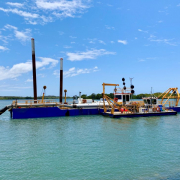
A $2.5 million dredging campaign in northern Gold Coast waterways will benefit boaties in one of the city’s fastest growing areas.

Work is underway on dredging Main Channel (North and South) in the Jacobs Well area.

The dredging is being done by south east Queensland company, Hall Contracting.

The channel is a key connection in the waterways network, giving boaties direct access to the southern parts of Moreton Bay Marine Park down into the northern end of the Broadwater.

The project is part of GCWA’s wider Waterways Management Program which will see $34.7 million invested in Gold Coast waterways over the next four years.

GCWA continues to receive strong feedback from waterways users wanting to see improved waterways access and the ability to travel to new destinations.

Dredging navigation channels so they remain safe and accessible enables people to go out and explore our waterways city.

The project also includes dredging of the Calypso Bay access channel on behalf of City of Gold Coast, which has responsibility for dredging these channels.

The dredged material will be placed in an approved area within the Calypso Bay residential development for beneficial reuse.

The dredging campaign is expected to be finished in May 2021.

https://gcwa.qld.gov.au/wp-content/uploads/2020/12/Main-Channel-dredging-December-2020-980x735-1.jpg 735 980 ydsgcwa https://gcwa.qld.gov.au/wp-content/uploads/2022/06/gold_coast_waterway_authority1.png ydsgcwa2020-12-09 12:17:272022-05-23 06:22:33Northern Gold Coast dredging benefits boaties

West Crab Island channel dredging supports our waterways city’s marine industries

May 8, 2020/in Project News/by ydsgcwa

GCWA is pushing ahead with dredging works on the Gold Coast, ensuring vital transport links remain open for our waterways city’s marine industries.

“Dredging is starting in the West Crab Island Channel in the section from the Ephraim Island bridge down to the intersection with the North Channel,” CEO Hal Morris said.

“South East Queensland-based business Q Sand North will be carrying out the works as part of our $27.6 million investment in the our Waterways Management Program.

“The Gold Coast’s waterways support 6,000 direct and indirect jobs and contribute $770 million directly and indirectly to the local economy every year, so it’s crucial we continue to support the industry, especially in the face of COVID-19.

“The channel which runs along the eastern shore of the Broadwater forms an important connection between Paradise Point, Runaway Bay and the wider marine channel network which supports access to marinas, manufacturing precincts, service centres and the canals to the west of the channel.”

GCWA will work with Q Sand North to ensure recommended health guidelines are implemented to manage and mitigate any potential impacts on the project by COVID-19 so that work can safely proceed.

The dredged material will be deposited in an approved site offshore to support beach nourishment on the eastern side of South Stradbroke Island.

This will replenish sand lost to erosion, improve storm resilience and provide habitat for marine animals.

Dredging is due to finish in June.

About 30,000 cubic metres of clean sand will be removed from the channel during the dredging campaign.

https://gcwa.qld.gov.au/wp-content/uploads/2022/06/gold_coast_waterway_authority1.png 0 0 ydsgcwa https://gcwa.qld.gov.au/wp-content/uploads/2022/06/gold_coast_waterway_authority1.png ydsgcwa2020-05-08 13:50:082022-05-23 07:13:08West Crab Island channel dredging supports our waterways city’s marine industries

Sand Bypass System Jetty Upgrade Reaches The Half-Way Mark

March 30, 2020/in Project News/by ydsgcwa

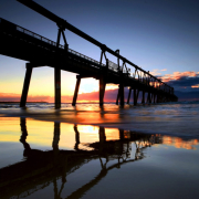
A major upgrade to the Gold Coast’s Sand Bypass System jetty has just passed the half-way mark, with 5 out of the 10 concrete slabs poured.

Once complete, the $3.35 million project will enable critical maintenance works to be carried out effectively and safely on the System’s jet pumps.

Extra beams are being installed underneath the jetty and the deck near each of the 10 jet pumps is being widened so the maintenance crane can continue to operate safely and keep the pumps functioning.

This will ensure sand continues to be pumped northward keeping the Seaway open for the recreation, tourism and marine industries.

For safety reasons, the jetty is still closed to the public until the project is finished late 2020.

Read more about the project here.

https://gcwa.qld.gov.au/wp-content/uploads/2022/06/gold_coast_waterway_authority1.png 0 0 ydsgcwa https://gcwa.qld.gov.au/wp-content/uploads/2022/06/gold_coast_waterway_authority1.png ydsgcwa2020-03-30 16:11:042022-05-23 07:17:46Sand Bypass System Jetty Upgrade Reaches The Half-Way Mark

Sand Bypass System jetty upgrade supports maintenance works for safe, navigable Seaway

October 28, 2019/in Project News/by ydsgcwa

A major upgrade to the Gold Coast’s Sand Bypass System jetty will ensure sand continues to be pumped northward keeping the Seaway open for the recreation, tourism and marine industries.

The Gold Coast Waterways Authority is investing about $3.35 million in the project which will enable critical maintenance works to be carried out effectively and safely on the System’s jet pumps.

CEO Hal Morris said the upgrade is essential as the pumps are the powerhouse of the Sand Bypass System’s operations.

“The pumps suck up sand from the seabed beneath the jetty and then the sand gets pumped underneath the Seaway to South Stradbroke Island, keeping this vital connection between the ocean and the waterways open for recreational and commercial vessels.

“We need to keep that sand moving because the Gold Coast’s beautiful waterways contribute $770 million each year to the local economy and support 6,000 direct and indirect jobs.”

Mr Morris said the ten jet pumps on the jetty require frequent maintenance which can only be undertaken when they’re lifted from beneath the sea floor by a crane on the jetty deck.

“This is one of the biggest upgrades we’ve undertaken on the Sand Bypass since it was built back in the 80s.

“Work starting today involves installing extra beams underneath the jetty deck and widening the decking near each pump so the maintenance crane can continue to operate safely and keep the pumps functioning.”

The contract to undertake the work has been awarded to local company, Alder Constructions.

Alder Constructions General Manager Dean Cheffers said the company undertook previous upgrade works on the jetty which were completed in 2006.

“Alder successfully collaborated with Gold Coast Waterways Authority to deliver a complete refurbishment and upgrade of the jetty in 2006, on time and on budget,” he said.

“With the knowledge of this particular site and project, along with our other bridge refurbishment experience, Alder possesses the specific skills required in every area of this contract.

“From our home base on the Gold Coast we have expanded to other regions in the south-east, but it’s always a privilege to be involved in iconic local infrastructure projects like the Sand Bypass System jetty.”

For safety reasons, the jetty will be closed to the public until the project is finished in September next year.

Public access to the beach beneath the jetty will also restricted from time-to-time while work is being done.

The Sand Bypass System is designed to replicate the natural northerly movement of sand along our coastline by transporting at least 500,000 m³ of sand under the Seaway to South Stradbroke Island each year.

Completed in 1986, the System was the first of its kind in the world.

https://gcwa.qld.gov.au/wp-content/uploads/2020/06/shutterstock_1118580182-980x652-1.jpg 652 980 ydsgcwa https://gcwa.qld.gov.au/wp-content/uploads/2022/06/gold_coast_waterway_authority1.png ydsgcwa2019-10-28 10:33:262022-05-23 07:34:58Sand Bypass System jetty upgrade supports maintenance works for safe, navigable Seaway

Surfers Riverside Edge Treatment gets special mention at Gold Coast Urban Design Awards

November 23, 2017/in Project News/by ydsgcwa

The Surfers Riverside Masterplan established a shared vision for a high quality public space that connects Surfers Paradise and the Nerang River and encourages enjoyment of the uniquely Gold Coast waterways.

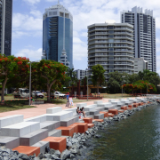
The Masterplan identified a need for an upgraded river edge treatment in Appel Park, requiring a design response to enhance it, including replacing the armour rock for protection against wave action. This provided an opportunity to redefine the edge of the river and to increase connectivity between the park and the river by improving pedestrian access to the water’s edge.

The built form was designed to be used in a variety of ways including as a platform to sit alongside the river, as steps down towards the water’s edge, as a barrier to prevent falls into the river and the functional purpose of protecting the embankment from damage caused by wave or tidal action. The new rivers edge was designed to take the eye to the water instead of detract from the river or impede the view.

The interlocking and staggered concrete blocks create aesthetic interest and seek to introduce colour to the river’s edge.  The selected colour reinforces the colour of the Poinciana flowers in the park and also helps to provide visual contrast and therefore improved safety along the river edge.

Further safety features included the staggering of the blocks to encourage interaction, yet stop people falling into the water, as well as identifying the oyster level and using that as a level to transition from the blocks to rock armour to discourage pedestrians from venturing to a level that would have oyster growth.

The built form created used a modular design and standard block sizes for ease of construction. The concrete blocks interlock with a pin connection to withstand water forces and movement.

This project shines a spotlight on the Nerang River so that the Gold Coast waterways become something that residents of the Gold Coast can use, understand, protect, respect, enhance and enjoy as much as the city’s beaches.

We’re thrilled to have received a special mention for our Surfers Riverside Edge Treatment project at the 2017 Gold Coast Urban Design Awards. The project was completed by GHD Woodhead.

https://gcwa.qld.gov.au/wp-content/uploads/2022/05/Final-completion_webpage1.jpg 1536 2048 ydsgcwa https://gcwa.qld.gov.au/wp-content/uploads/2022/06/gold_coast_waterway_authority1.png ydsgcwa2017-11-23 15:34:372017-11-23 15:34:37Surfers Riverside Edge Treatment gets special mention at Gold Coast Urban Design Awards
Page 7 of 7«‹567

–

  • Spring clean for Wave Break Island ahead of summer
  • Simpler speed rules for Paradise Point Channel trial
  • Paradise Point Channel speed limit trial
  • 2026 Waterways Management Program released
  • Dredging underway in the Gold Coast Seaway
  • Keeping the Gold Coast waterways accessible and safer – Compliance Update
  • Investing in the Sand Bypass System for the Future
  • Operation Clearwater delivers improvements for Gold Coast waterways
  • Operation Clearwater delivering results across the Broadwater
  • Gold Coast Seaway marks 40 years of coastal engineering and connectivity

  • 40-44 Seaworld Drive
    Main Beach Qld 4217

  • PO Box 107
    Southport Qld 4215

  • 07 5539 7350
  • mail@gcwa.qld.gov.au

Who’s Who in the Blue

Who’s Who in the Blue explains who is responsible for managing, protecting and
regulating Queensland’s waterways, particularly on the Gold Coast.

It clarifies agency roles across safety, environmental protection, pollution response,
compliance and infrastructure, helping avoid confusion and duplication.

Overall, it’s a quick reference guide that supports coordination, accountability and
effective waterway stewardship.

Download Who’s Who in the Blue

Acknowledgement of Country

The Gold Coast Waterways Authority acknowledges and pays respect to the traditional custodians, the Yugambeh peoples of South East Queensland, including the Kombumerri, Mununjali, Wangerriburra, Bullongin and other clans, and their Elders past, present and emerging. We recognise their unique and ongoing spiritual and cultural connection with the land and waters of the Gold Coast area.

Any damaged or missing aids to navigation such as beacons, buoys, markers or signs, should be reported as soon as possible on 07 5539 7350.
For community engagement, communications or media enquiries please contact mail@gcwa.qld.gov.au

Access, Management & Destinations

  • Access & Management

    Information on Anchoring & Mooring, Boating, Dredging, Operations Team & Tidal Works

    Learn More

  • Our Destinations

    GCWA managed multi-use destinations, building infrastructure for commercial and recreation use of Gold Coast waterways.

    Learn More
© 2026 Copyright - Gold Coast Waterways Authority | Website By: YDS
  • Facebook
  • Instagram
  • LinkedIn
  • Right to Information
  • Privacy
  • Disclaimer
  • Copyright
Scroll to top

Status: Closed

The Sand Bypass System (SBS) jetty is a working platform and is closed to the public whenever construction activity, sand pumping operations or maintenance works are underway, or during severe weather events.

For safety reasons, the jetty will remain closed until the end of 2026 while essential maintenance and ongoing sand pumping operations continue. We appreciate your understanding.

To find alternative jetty facilities, please visit the GCWA Destinations Map.

Disclaimer

GCWA’s tidal works mapping is a public resource for general information purposes only.

The tidal works mapping is not a cadastral survey or hydrographic survey product. It should not be relied upon as the basis for making any decision, whether a business, conveyance, development, property boundary, property description, property title, property transaction, or any other decision.

GCWA makes no warranty, representation, or guarantee, express or implied, as to the accuracy, completeness, content, reliability, suitability, or timeliness, with respect to the information or related graphics.

GCWA has taken care in preparing the mapping information, but accuracy is not guaranteed, and the information contained in the tidal works mapping must not be construed or used as a legal description of any property. Under no circumstances will GCWA be liable for any damages whatsoever, including business interruption, loss of business information, loss of data, loss of profits, property valuation, or any other damage, arising from use or misuse of this tidal works mapping.

Any errors or omissions should be reported to GCWA in writing by email to mail@gcwa.qld.gov.au.


Status: Closed

The SBS jetty is a working platform and for safety reasons is not open to the public during construction projects, when operating, undergoing maintenance or during severe weather events.

Until the end of 2025 while maintenance works, and sand pumping operations take place, the jetty will be closed.

Your understanding is appreciated, to find alternative jetty facilities please visit the GCWA destinations map.

Disclaimer

Tidal works mapping information

GCWA’s tidal works mapping information is a public resource for general information purposes only. It is not a cadastral survey or hydrographic survey product. It should not be relied upon as the basis for making any decision, whether a business, conveyance, development, property boundary, property description, property title, property transaction, or any other decision. GCWA makes no warranty, representation, or guarantee, express or implied, as to the accuracy, completeness, content, reliability, suitability, or timeliness with respect to the information or related graphics. GCWA has taken care in preparing the mapping information, but accuracy is not guaranteed, and the information contained in the GCWA Open Data Portal must not be construed or used as a legal description of any property. Any errors or omissions should be reported to GCWA in writing by email to mail@gcwa.qld.gov.au. Under no circumstances will GCWA be liable for any damages whatsoever, including business interruption, loss of business information, loss of data, loss of profits, property valuation or any other or damage arising from use or misuse of this mapping information.

Go To GCWA Open Data Portal

I want to talk to someone about...

I want to talk to someone about… Officer Phone number
reporting oil pollution, a significant navigational hazard, or a damaged aid to navigation.Waterways Vision and Waterways Management Strategy Waterways Operations Crew 07 5539 7350
a media issue Senior Communications Advisor 07 5539 7350
a project Program Delivery team 07 5539 7350
the Sand Management Plan Planning and Innovation team 07 5539 7350
Waterways Access

·         Dredging

·         Public pontoons & other marine infrastructure

·         Sand Bypass

Program Delivery team 07 5539 7350
Waterways Management Waterways team 07 5539 7350
·         Anchoring and Mooring Compliance

·         Aquatic Events

·         Doug Jennings Park

·         Abandoned vessels

·         Aircraft take-off and landing permits

Waterways team 07 5539 7350

07 5539 7350

·Navigation Aids

·Signage

·Pollution

Waterways Operations Crew 07 5539 7350
Marinas Waterways team 07 5539 7350
Private pontoons, jetties & boat ramps Waterways team 07 5539 7350
Buoy Moorings Planning and Innovation team 07 5539 7350
Executive Governance 07 5539 7350
GCWA Board, CEO matters 07 5539 7350
Community Engagement, Sponsorships & Partnerships Community Engagement Officer 07 5539 7350
Business Management Business Services team 07 5539 7350
Accounts Payable – General Accounts Business Services team 07 5539 7350
Accounts Payable – Projects Program Delivery team 07 5539 7350
Accounts Receivable Business Services team 07 5539 7350
Sand Bypass Status

Status: Closed

The SBS jetty is a working platform and for safety reasons is not open to the public during construction projects, when operating, undergoing maintenance or during severe weather events.

Until the end of 2025 while maintenance works, and sand pumping operations take place, the jetty will be closed.

Your understanding is appreciated, to find alternative jetty facilities please visit the GCWA destinations map.